Hydrographic and Geophysical Site Evaluation
Ultrabeam Hydrographic specialises in geophysical site evaluation for marine infrastructure, energy, and environmental applications.
While traditionally associated with nautical charting for safe navigation, hydrographic surveying has evolved into a sophisticated, multi-disciplinary field.
Today, it encompasses the measurement of tides, currents, and wave action; mapping of the seafloor and shallow geology; and observation of marine ecological conditions—critical inputs for modern marine engineering.
This data underpins the growing demands of offshore energy, renewables, and coastal development, where accurate geophysical insight is vital to project success.
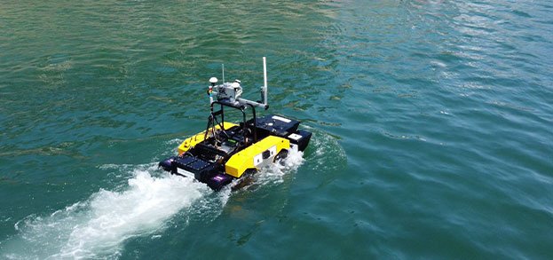
Ultrabeam’s experienced team combines leading-edge survey equipment, specialist software, and remote autonomous technologies to deliver high-quality, cost-effective solutions. Our flexible, rapid mobilisation capability allows us to operate from vessels of opportunity or third-party platforms—regardless of size or location.
We operate a comprehensive range of geophysical instruments including multibeam echo sounders, side-scan sonar, magnetometers, and sub-bottom profilers. In partnership with a Cornwall-based specialist, we also offer Ultra High Resolution Seismic (UHRS) services for enhanced subsurface imaging.
All data is acquired and processed using industry-leading software. Our geomatics and hydrographic teams collaborate to produce high-resolution deliverables that consistently meet—and exceed—client expectations.


Backed by decades of experience with projects successfully completed throughout the UK, Europe, Middle East, Africa and Asia we’re ready to deploy our team and unique equipment wherever your next challenging project takes you.
View our services