Ultra-high Resolution Marine Asset Survey and Inspection
Ultrabeam Hydrographic delivers high-definition subsea mapping and 3D visualisation of in-water structures using state-of-the-art precision sonar and laser technology.
We’re setting new industry benchmarks in 3D data acquisition, point cloud rendering, and visualisation—powered by our own advanced, in-house survey tools and methodologies.
Innovation
Innovation drives everything we do. We challenge conventional marine surveying by combining unique in-house hardware solutions with advanced software and digital analysis tools. A continual commitment to research and development keeps us ahead of industry demands, delivering smarter data acquisition, faster processing, and clearer insights for complex marine infrastructure projects.


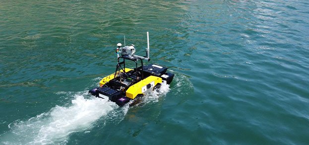
Autonomy
Autonomy is at the heart of our operations. Our custom-designed uncrewed surface vessels (USVs) offer exceptional control, precision, and safety—particularly in environments where traditional surveying is difficult or hazardous. By leveraging advanced autonomous systems, we increase operational efficiency, reduce risks, and ensure high-quality data with greater consistency and repeatability.
Technology
We harness the latest technology to deliver outstanding survey results. Our integrated platform combines high-resolution sonar, laser scanning, imaging sonar, and advanced digital analysis tools. Through industry-leading software and data processing workflows, raw datasets are transformed into detailed, actionable visualisations—providing engineers, asset managers, and project teams with the insights they need to make confident, informed decisions.


Backed by decades of experience with projects successfully completed throughout the UK, Europe, Middle East, Africa and Asia we’re ready to deploy our team and unique equipment wherever your next challenging project takes you.
View our services